• Logbook
• Where are we?
Photo album:
• Northland (East Coast)
Recommended services:
• Russel Top 10 Holiday Park
Did you find our website useful?
THANK YOU!
Leg breakdown:
Date Activity Leg Distance (Km) Elev. Gain (m) Elev. Desc. (m) GPX Profile 8-Nov-18 Riding Mangawhai Heads to Whangarei Abbey caves 82.8 713 609 GPX Profile 9-Nov-18 Hiking Riding Whangarei Abbey caves to Whangarei falls 15.9 67 42 GPX Profile 10-Nov-18 Riding Whangarei falls to Tutukaka 23.6 156 222 GPX Profile 11-Nov-18 SCUBA Poor Knights Islands 12-Nov-18 Riding Tutukaka to Mimiwhangata (Waikahoa Bay) 36.5 419 414 GPX Profile 13-Nov-18 Riding Mimiwhangata to Taupiri Bay 38.7 624 644 GPX Profile 14-Nov-18 Riding Taupiri Bay to Russel 27.9 269 297 GPX Profile 15-Nov-18 Hiking Urupukapuka Island 8 184 167 GPX Profile 17-Nov-18 Riding Russel to Aroha Island 33.7 300 327 GPX Profile 18-Nov-18 Riding Aroha Island to Tauranga Bay 55.7 698 708 GPX Profile 19-Nov-18 Riding Tauranga Bay to Mangonui 44.6 314 294 GPX Profile 20-Nov-18 Riding Mangonui to Pukonui 63.9 276 286 GPX Profile 21-Nov-18 Riding Pukonui to Waitiki Landing 49.7 261 273 GPX Profile 22-Nov-18 Riding Waitiki Landing to Cape Reinga to Bluff camp 75.5 678 686 GPX Profile
7-22 November, 2018: Northland's East Coast
Our first day in Northland still goes through dairy land along with continuous ups and downs. The climbs are not very long or very steep, but at the end of the day they end up being a leg burner. We are convinced that the force of gravity in New Zealand depends on whether you ride up or down. Of course, being greater when you ride up. If they were the same, it should be possible to climb the slope that comes at the end of the descent without pedaling, when both are approximately the same height. Yes, yes, we know about the resistance force with the road and the air friction and all that. But we don´t even reach a quarter of the next climb! There is something fishy here. Has anyone proven that the laws of classical physics work the same in the Southern Hemisphere as in the North?
On our first night in Northland we stay at the Little Earth lodge, a place that reminds us of the song "Hotel California". Everything is a little mysterious, even mystical. The old lady who welcomes us is extremely friendly. A good-looking young couple greets us euphorically from the kitchen porch and praises our achievement of arriving by bike. The long corridor that leads to our room, the furthest from the exit, has a couple of Buddha statues and is dimly lit. The old lady is in a hurry to sign us up in the guest book. It's almost as if we were signing a contract. That's when we remember that part of "you can check out any time you like, but you can never leave." The next morning everything seems normal and we think we will be able to leave the place without problems.
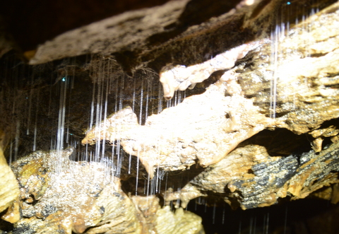
Once inside the first cave, we turned off our headlamps and wait in the dark. As our eyes adjust to the darkness, magically, blue dots begin to appear on the ceiling. It’s like gazing at the stars but underground! These caves are actually part of a subterranean river that has been eroding its way through the limestone. Sometimes the stream is thigh-high, but most of the time the water level is below our knees. In a calm corner of the stream we see an eel. At that moment we remember the scene of Gollum in his cave devouring a fish still kicking. Maybe the old lady at the lodge is an emissary from Mordor... The caves are linked by short hikes that run through meadows with flowers. There are other tourists visiting the caves, but they are not as well equipped as we are and they miss the glow worm’s magical show. However, they do not miss the image of two crazy people dressed up with helmet and bike shorts, headlamps and rubber shoes walking on the blooming meadows. Since the caves are so close to each other, it's not worth taking all the gear off.
Back to the lodge, we begin to load the paniers on the bikes when the old lady comes to ask us about the visit. We tell her that we liked it a lot, that it went very well, etc. We seem to see in her eyes some strange bright spiraling sparkles so we hurry to finish the preparations just in case she is trying to hypnotize us and make us stay another night.
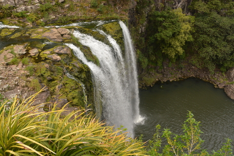
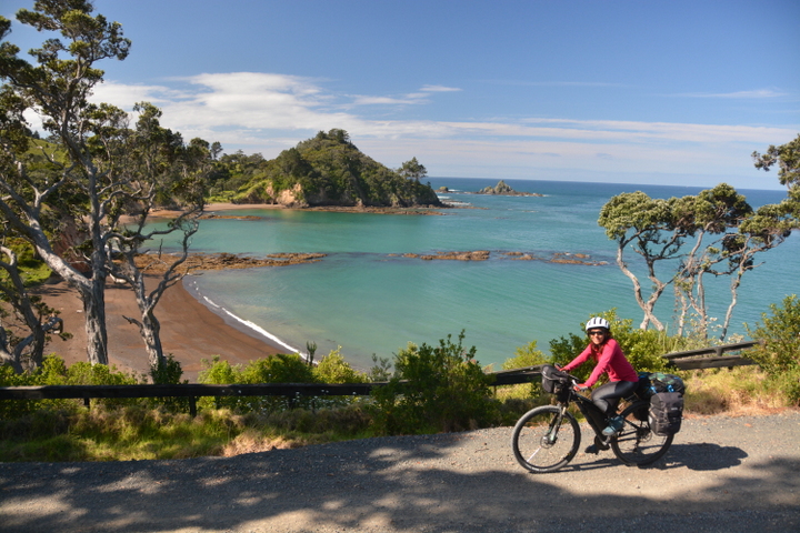
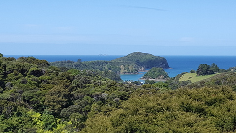 From Whangarei we head towards the East coast where we will continue our way North, following the coves and bays of this rugged coast, with cold and intense blue waters. Our first stop is Tutukaka, whose main interest is its proximity to the Poor Knights Islands, a marine reserve cataloged as one of the 10 best places in the world for diving. We did the PADI course in Barcelona about 30 years ago and it has been at least 10 since our last dive in Hawaii, so we sign up for a refresher program. The first dive will be with a dedicated dive master to go through the basics and the second with a group with little experience. During the first dive we consume half of the air just with the refresh exercises. With what we have left, we start to swim around but we are more concerned controlling our buoyancy than appreciating the marine life. During the second dive we are more relaxed and, in addition to schools of fish, we spot several interesting things like nudibranchs, a school of tiny jellyfish, sponges of various colors and a fish protecting its eggs attached to the rock. The water is at 16 degrees Celsius! Even with the neoprene vest under the 7 mm wetsuit, we swim back to the boat shivering. The crew on deck has already prepared tea and hot chocolate to stop the shakes, but some of the other divers shiver so violently that they cannot hold the cup without spilling the contents.
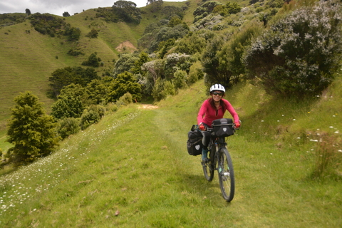
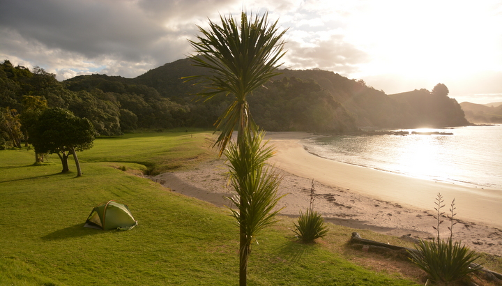
The campsites where we spend the nights are gorgeous: soft grass to pitch the tent on the very beach front. The best are those located in small coves and especially if we are alone, as has happened on several occasions. We have not yet gotten used to sitting on the grass, under a tree fern watching the waves break on the golden sand. One of the best campsites was at Waikahoa Bay, near Mimiwhangata. It is a DOC campsite, which means a basic campground. Very basic. The shower is a hose connected to a tank that collects rainwater and the toilet has no running water.
To get to this one, we have to push the bikes uphill on steep and narrow stairs. While Judit pushes from behind, Cèsar pushes from the handlebar. At one point Cèsar slips and to avoid falling downhill he grabs onto the panier. Catacrak! The bike rack is not designed for that lateral load. Fortunately, the piece that has broken is the one that connects the bike frame to the rack and not the rack itself. After setting up the camp we tackle the repair. The situation worsens when the head of the screw connecting the broken part to the frame breaks, when trying to loosen it. The threaded hole in the bike frame for the rack has become unusable, filled with a screw without head. At that moment, all the magic of the remote cove becomes a serious problem. As Judit says, where there is a problem, there is a solution. Maybe we can take advantage of the screw that holds the disc brake caliper. Searching through our spare parts, we find a sort of mending plate that can do the trick. The kludge requires numerous failed attempts, but after a couple of hours we succeed. The cove is wonderful again.

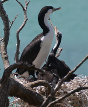
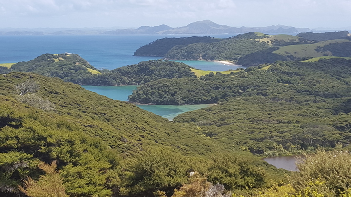
When we leave Russel, we cross the bay by ferry to Paihia and continue along the coast. Our next destination is the Aroha Island. It’s no longer an island, because it is connected to mainland by a permanent causeway between the mangroves. Aroha is supposed to be a good place to see kiwis in the wild. Kiwis are nocturnal birds, so it requires some effort to see them. But what we did not know is that they are very territorial. We found out about it in a way that was disappointing and comical at the same time. When the assistant at the visitor’s center tells us where the two kiwis on the island can be spotted, Judit asks:
- You mean two of the kiwi species that inhabit the island, right?
- No, no. On the island there are two kiwis, one female and one male. The female is 40 years old and she is no longer lays eggs. The fact is that kiwis are very territorial and they do not let any other kiwis enter the island.
So, tonight we will share the possibility of seeing 2 kiwis with the other 10 or 15 visitors staying at the campsite on an island less than half a kilometer from end to end. The assistant provides us with a red cellophane to cover the headlamps to avoid scaring the two kiwis away. When we go out for the kiwi walk half an hour after the sun sets, we meet all the other visitors scattered around strategic points. If I were one of the two kiwis, I would stay in my hole all night so that I would not be hunted by all the red-eyed cyclops wandering the forest. We suppose the kiwis must be very hungry or tired of their burrow underground, because after an hour of searching and waiting, we hear them. First the male, then the female. We know how to recognize them because we asked how their call sounds like at the visitor’s center. The assistant picked up a stuffed kiwi from the gift shop and pressed it to reproduce the sounds they make. We also heard other kiwis further away, probably off the island. After a while we go back to the tent without seeing them. What has impressed us most about the information panels at the visitor’s center is the size of the egg that the female lays. A North Island brown female is about the size of a large chicken, but the egg she lays is about the size of an ostrich's egg. Well, maybe the comparison is a little exaggerated, but not much. No wonder the female of the island Aroha has stopped laying!
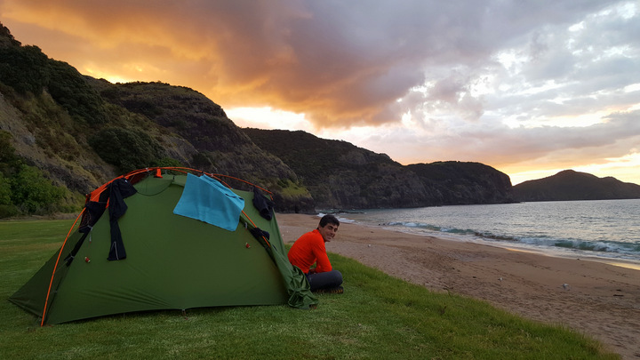 We continue skirting the East coast approaching the base of the Aupouri peninsula, which will take us to Cape Reinga, the North end of the North Island. Our luck with the good weather is over. When entering the peninsula it starts to rain and the forecast indicates rain for the next 5 days. This area is more uninhabited than the rest and we need to plan where to buy supplies. Also how to avoid getting wet more than necessary during the days that will take us to reach Cape Reinga. Between the next two storms there is one sunny day, which coincides with the day we could reach the northern tip, so we go for it.

In the two days it takes us to get from Mangonui to Waitiki Landing we get wet a few times. We see constant waves of gray clouds passing from West to East. When the sky darkens and big drops begin to fall, we put the Gore-Tex jacket on quickly because we know what's coming next. The rain becomes more intense and lasts a few minutes. Then the intensity goes down and stops raining. The dark clouds are pushed away by innocent white clouds and even patches of blue sky appear. When it rains, we seek shelter under a roof or thick trees. The first of the showers falls on us while crossing the town of Waipu. We find shelter in the office porch of what looks like a sawmill. It also turns out to be a workshop for artists who work with Kauri wood. The Kauri is protected by law but they unburied a fallen trunk, which is allowed. The manager proudly shows us a photo of the size of the trunk and for sure they will have wood for a lifetime. His artists specialize in carvings of Maori symbols and weapons. The Kauri wood is beautiful and the art pieces spectacular, especially when combined with colored glass and even with whale bone.
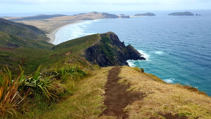
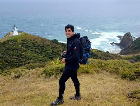 Finally the day has come to conquer the northern tip of New Zealand, Cape Reinga. We ride from Waitiki Landing without luggage, because to get to our next destination (the West Coast) we have to backtrack most of the way. Once in Cape Reinga, although the sky is gray and overcast, there is enough visibility to see the line where the Tasman Sea with the Pacific Ocean join, or rather collide. In that area the waves come from the East and the West at the same time and draw a line of white ridges that delimit the two seas. This place is sacred to the Maori. They believe that the souls leave for the other world through a Pohutukawa tree (Christmas tree) on one of the steep cliffs of the cape.

Cape Reinga marks the northernmost geographical point that we can reach by road. Here we start our return to Auckland, but now following the West Coast. We expect long beaches and forests of Kauris and of course more ups and downs. Probably more ups than downs. And don’t forget the showers. But all that will come in the next story.
© 2018 Explore Pangea. All Rights Reserved. Website Terms of Use.
