• GPX file
• Profile
• Logbook
• Where are we?
Photo album:
• Hauraki Gulf Islands
Recommended services:
Did you find our website useful?
THANK YOU!
Leg breakdown:
Date Activity Leg Distance (Km) Elev. Gain (m) Elev. Desc. (m) 5-Dec-18 Hiking From Claris to Kaiaraara hut 19.9 436 397 6-Dec-18 Hiking From Kaiaraara hut to Mt. Heale hut 17.4 669 298 7-Dec-18 Hiking Windy Canyon 9.3 530 518 8-Dec-18 Hiking From Mt. Heale hut to Claris 8.9 51 429
2-8 December, 2018: Hauraki Gulf Islands
We only spend two days in the Waiheke Island and the rain doesn’t stop. The only highlight is the visit to the restaurant of one of the wine cellars. The lamb is absolutely delicious but we like the Rioja wine better.
The day we leave Waiheke, we get up before 5 am to catch the 6 am ferry. In half an hour we are in the port of Auckland. In 40 minutes we pedal to our AirBnB, where we reorganized the backpacks. Wego to buy supplies and we Uber to the domestic airport. The plane that takes us to Great Barrier Island (Aotea in Maori) can carry 8 passengers plus the pilot. When we get off the golf cart that takes us from the terminal to the plane, the woman of the other couple that flies with us looks scared. Once in the air, at every turbulence, she grabs his partner’s hand. After a few bumps she gets used to it and starts to enjoy the trip. We fly over Waiheke, where we took the ferry a few hours ago, but the sky is overcast and the visibility is not good. When we reach Aotea it starts to rain. We can see the landing strip between two strips of grass. The pilot begins to descend aligning with the right grass strip. The woman begins to exert pressure on her partner's hand. We continue descending and the pilot does not correct the orientation. We hear the partner’s metacarps crack. After landing on the grass, the pilot turns around and with a malicious smile informs us that the landing is on the grass because it is softer for the wheels.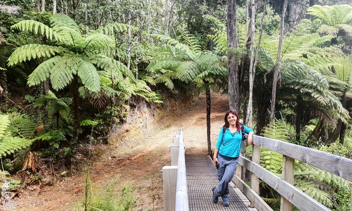
We make the final preparations at the Claris microairport and start our hike. The first 6 km follow the road and have no interest. We deviate onto the forest track and begin to climb the trail that will take us to the Kaiaraara hut, where we will spend the first night. The track is an old road used by kauris loggers, now maintained by the DOC. As always, the variety of plants is amazing. The tea trees dominate, along with young kauris, fern trees and palm trees. The undergrowth is impassable.
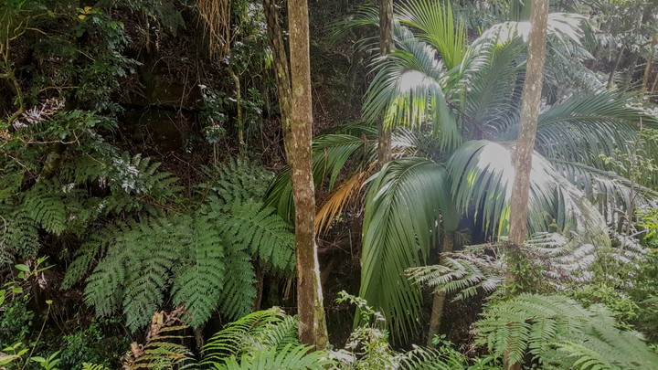
From the Maungapiko viewpoint we can see the island highest peaks. Several of them end in bare sharp rocks that the vegetation has not managed to colonize. Another detour of the track brings us closer to two pretty good size kauris that escaped the logging. Informative panels educate us about their reproduction system, common with other conifers. The male cones are smaller and generate pollen. The females are spherical and produce the seeds when they are geminated by pollen. The males are usually found in branches superior to the females to facilitate pollination.
After 20 km. we arrive at the hut that we share with a group of young people. It's been a long day so we prepare dinner and go to sleep.
In theory, our second day of the Aotea track is short, which would have been good to recover from yesterday’s, but a series of inconveniences makes it another hard day. Still ignorant of what awaits us, before we start, we take a walk to the nearby beach from where we can see the Fitz Roy Bay, one of the ports where the ferry arrives. On the beach there is a pair of brown teals, a kind of threatened duck that we had only seen on the road signs. We return to the refuge and start towards Mount Heale hut, where we will sleep tonight. We had decided to follow the South Fork route but the GPS map and the reality do not match so we go back to try another variant. This second trail should cross the river that passes through the refuge but farther upstream. After the last visible mark we go up the river bank but the path has disappeared on our side and don’t see any marks on the opposite bank. At that moment we get the first shower of the day. We take refuge under a giant fern while we put the Gore-Tex on and we wait patiently. This second attempt to follow the South Fork is getting complicated and with the rain we decide to play it safe and follow the official route between huts. So we turn around for the second time. By the time we pass next to last night’s hut, we have already hiked 9 km and we are starting over!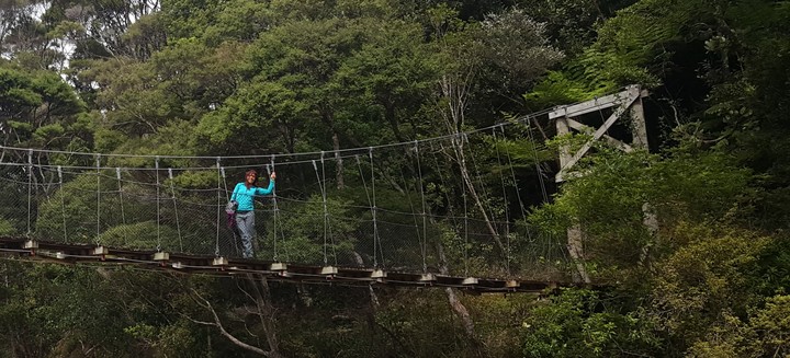
After a mental reset we start to follow the Kaiaraara dam track, the official trail. We are entering the heart of the island. It seems impossible for us to hike out of the trail due to steep slopes, the thickness of the forest and the cliffs that descend from the rocky peaks. However, this area was deforested from kauris a century ago. It seems unthinkable to cut giant trees and moving them around. The trail passes near the remains of a wooden dam used by the logging company. For months the loggers accumulated the kauri trunks in the dam while it was filling with water. When they had enough logs, they opened the mobile gate and the giant trunks came down the river, all the way to the plains, from where they were transported to the sea. There they were tied to each other and towed to the lumber yards in Auckland. Unfortunately, only the dam base remains. In 2014, a very strong storm in this area destroyed it almost completely. Maybe that storm also washed out the South Fork trail.
The trail passes through several areas where there have been landslides. This is where we have the best views and we can see how rugged the orography of the island is. This third variant goes to the summit of Mount Hobson (Hirakimata), the highest on the island. We had planned it for tomorrow but due to the itinerary change, we have to climb it today. The terrain is so abrupt and the slope so wild that the DOC has built stairs to make it accessible. We have not count them but we are talking about a few thousand steps. No exaggeration.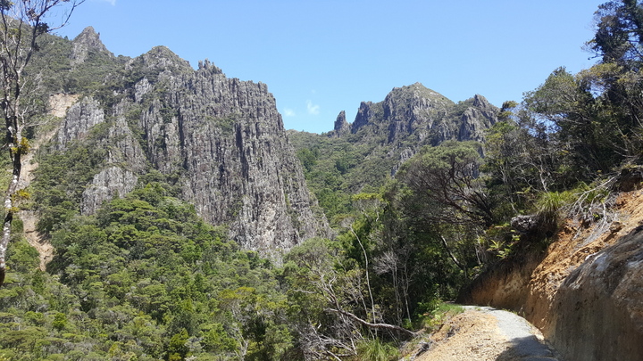
In the last section up to the top, the stairs are raised from the ground and connected between them by platforms so that we are always about a meter above ground. All these structures have been built to protect the nesting area of the black petrel. These birds are classified as vulnerable and only nest near the top of Hirakimata and on Little Barrier Island, opposite to ours. Black petrels return every year from Australia, Mexico or Ecuador to lay one egg in the same burrow. Feral cats and wild boar introduced by man eat eggs, chicks and even adults if they can catch them. We have been told that when they arrive from their transoceanic trip, they are so exhausted that they simply crash into the bushes and for a few minutes they lay on the ground stiff while recovering. During the nesting season both parents take turns fishing for several days and return to the nest with their bellies full of fish and squid. The shift change happens at night. Like many other New Zealand animals, if you want to see the black petrels, it has to be at night.
The view from the platform at the top of Hirakimata is not as spectacular as it could be, since the visibility is not good. We continue with more stairs to Mt. Heale hut. There are no other hikers. It is also better equipped than Kaiaraara and has large windows facing West, looking directly at the Little Barrier Island. It is cold inside but we put a few benches in front of the window, a mattress on top of them and cuddle in the sleeping bags to wait for the sunset.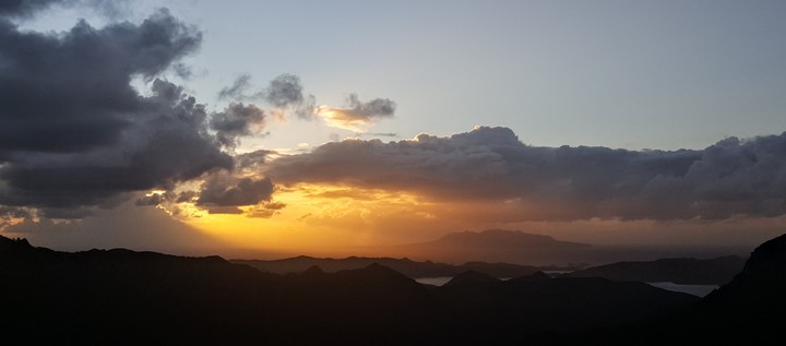
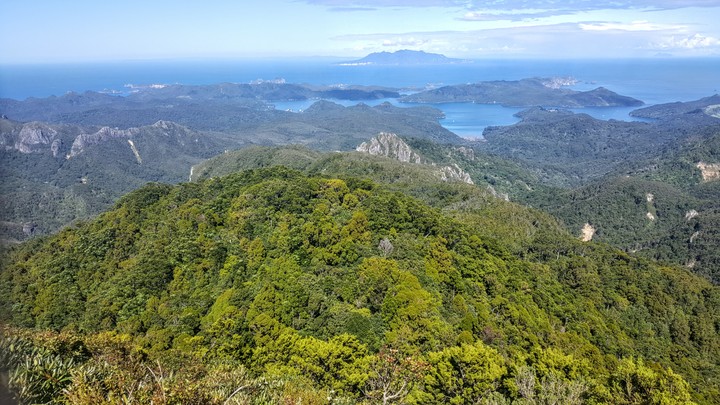
On our third day, the sun shines. The hike to the Windy Canyon passes again through the Hirakimata and today the view is magnificent in any direction. We can see one bay on the West coast and two on the East. The forest blanket is only interrupted by the sea, torn by landslides or pierced by rocky peaks. The Windy Canyon however is not as spectacular as we were expecting. Today we have counted the stair steps they add up to 4140. So yesterday we climbed for sure more than 5000. Our calves are burning and when we arrive back to the Mt. Heale hut we do as the black petrels. We crash on the sunny platform outside and lay stiff, with convulsive movements in our legs, as if we were given electric shocks. The pleasant feeling of the sun on our clothes awakens the reptilian instincts and we begin to undress. What a pleasure!
The pain on the next day is even worse. The quadriceps and buttocks are good, probably because of the 1000 km we have already ridden, but the calves are a mass of sore muscle fibers. The descent from the hut to the airport has a few hundred more stair steps. The hips dislocate at each step to mitigate the pain. It's like taking Robocop with you on a hike. Of course, when we meet other hikers we smile and make a titanic effort to walk normally.
The route goes through a forest of very tall tea trees, about 20 meters. The first Europeans gave it that name because they used its leaves as a substitute for tea. The Maori name is manuka or kanuka, depending on the species. These trees were considered a weed by the settlers. However, nowadays they have great value for their supposed antibacterial and antimicrobial properties. Manuka honey is also very valuable.
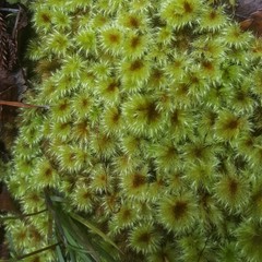
As we lose elevation the vegetation becomes more tropical. Palms and yuccas replace the kauris. We go around some wetlands where a kind of reeds and other aquatic plants abound. We arrive at one of the today’s highlight spots: a hot springs stream. We hope that its waters are miraculous and cure our sore. The water is warm, rich in sulfur and silver, but totally useless for our pain. We still have an hour to the road and then another hour and a half to the airport. When we get to the road we see a rundown Land Rover approaching and as an impulse ordered by the hypothalamus, our arms extend towards it with our thumbs pointing sideways. The 4x4 stops and takes us to the airport! Once again, we thank the kindness of New Zealanders.
Our next adventure will be in Australia, where we will meet a couple from our rescue team and some of their Australian friends to do some cannons in the Blue Mountains.
© 2018 Explore Pangea. All Rights Reserved. Website Terms of Use.