• Logbook
• Where are we?
Photo album:
• Northland (West Coast)
Recommended services:
Did you find our website useful?
THANK YOU!
Leg breakdown:
Date Activity Leg Distance (Km) Elev. Gain (m) Elev. Desc. (m) GPX Profile 22-Nov-18 Riding Waitiki to Bluff campground 75.5 678 686 GPX Profile 23-Nov-18 Riding Bluff campground to Ahipara 61.6 59 32 GPX Profile 25-Nov-18 Riding Ahipara to Rawene 68.9 538 499 GPX Profile 26-Nov-18 Riding Rawene to Waipoua forest 63.7 836 801 GPX Profile 27-Nov-18 Riding Waipoua forest to Kauri Coast 22.2 327 376 GPX Profile 28-Nov-18 Riding Kauri Coast to Matakohe 78.7 277 318 GPX Profile 29-Nov-18 Riding Matakohe to Kaiwaka 38.2 442 377 GPX Profile
22-29 November, 2018: Northland's West Coast
After visiting Cape Reinga, the most northern point of New Zealand, we head to the West coast of the Aupouri peninsula, in the Northland region, to begin our way back to Auckland. This route includes several interesting points such as the Te Paki giant dunes, the 90 miles beach and the Kauri forests.
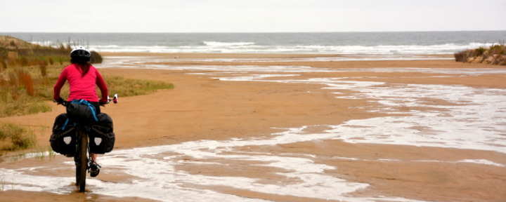
Our goal for the first night is the campground in Bluff, already on the 90 miles beach. To get there, first we have to reach the Te Paki giant dunes, ford the stream of the same name and then take the beach South towards the DOC campsite. Crossing the mouth of the stream and riding on the beach must be synchronized with the low tide to be able to ride on firm sand. We have been told that if the tide is high, the only sand left out of the water is too soft to ride.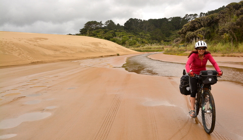
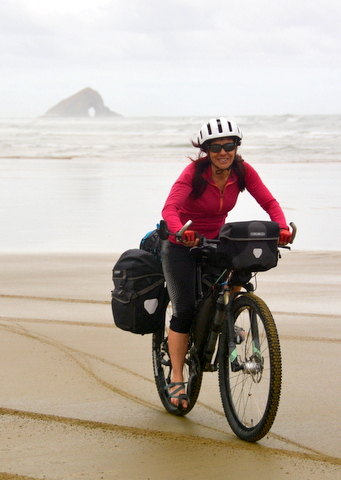
Since we started crossing the Te Paki stream, we have been pedaling in sandals to avoid getting our boots wet. At this point, our feet and a good part of the bike and panniers are coated in sand. Every time we brake, the discs squeal in pain crushing the sand grains. It’s a shriek that makes us cringe. The chain sounds like a coffee grinder with dull blades. Pedaling on the beach is probably the best way to mess up the bikes´ drive train. But the 90 miles beach is a classic and classics have a special weight when deciding the route you take. At the beginning of the beach the novelty keeps us alert and smiling. As the kilometers go by, it becomes monotonous and even boring. Others find it mystical and inspiring. Maybe on a sunny day, but with this chilling fog and the bikes screeches, it seems the entrance to purgatory.
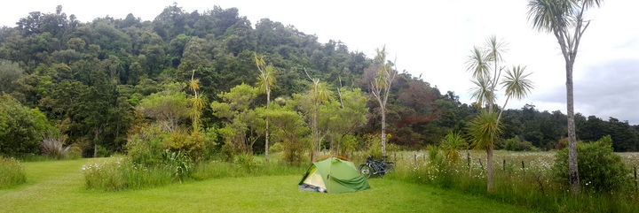
Finally we reach the rocky point next to our campsite today. It is a rock that can be accessed on foot at low tide. Just past the isthmus that joins it to land, we leave the beach, drag the bikes up a sandy road and arrive at the campsite. There are 6 or 7 tents from the hikers or “walkers” of the Te Araroa trail, the hiking trail that goes from Cape Reinga to Bluff, the southernmost point of the South Island (not the campsite of the same name that we have just arrived at). This campsite is extremely basic. It doesn’t even have drinking water, but it´s a flat spot to spend the night.
.jpg) When we get up the next day, all the tents have disappeared. All the walkers have already left. We have to wait for the tide to go out. The low tide is at 4 o'clock in the afternoon so there is no hurry. We inspect the bikes and we almost start crying. The sand mixed with the chain lubricant will be polishing the links during the remaining 60 kilometers. We clean it the best we can, but the space inside the links is not accessible for our toothbrush. Well, for the toothbrush we use to clean the chains. Let´s be clear. In total we have three toothbrushes and only one is for the chains. On top of that, it is always the same one. Since we can´t do much about the sand, we add some lubricant. Hopefully at least it quiets the grinding noise. Finally we start riding. One by one we catch up with the walkers. For us the 90 miles beach is a day and a half, but for them, at least three, assuming they are capable of walking 30 km each day. The route has few distractions. Occasionally we pass areas full of empty shells that crush under our tires. The seagulls try to break the full ones, dropping them from high up. The little dots initially diffused in the distance become people or vehicles as we get closer. Tourists take pictures of us from the road accesses that we pass or from the bus that brings them from Cape Reinga. We make bets to guess the distance to some faraway landmark. In short, we try to distract ourselves as much as we can between long stretches of solitude. Finally we arrive at Ahipara, the village at the southern end of the 90 miles beach. Evidently, today we have not had any climbs but we are tired anyway. With the additional friction of the sand, the day has been equivalent to pedaling a gentle uphill during the 60 km. It is probably worth doing the 90 miles beach, but if it was much shorter it would be just fine.
When we get up the next day, all the tents have disappeared. All the walkers have already left. We have to wait for the tide to go out. The low tide is at 4 o'clock in the afternoon so there is no hurry. We inspect the bikes and we almost start crying. The sand mixed with the chain lubricant will be polishing the links during the remaining 60 kilometers. We clean it the best we can, but the space inside the links is not accessible for our toothbrush. Well, for the toothbrush we use to clean the chains. Let´s be clear. In total we have three toothbrushes and only one is for the chains. On top of that, it is always the same one. Since we can´t do much about the sand, we add some lubricant. Hopefully at least it quiets the grinding noise. Finally we start riding. One by one we catch up with the walkers. For us the 90 miles beach is a day and a half, but for them, at least three, assuming they are capable of walking 30 km each day. The route has few distractions. Occasionally we pass areas full of empty shells that crush under our tires. The seagulls try to break the full ones, dropping them from high up. The little dots initially diffused in the distance become people or vehicles as we get closer. Tourists take pictures of us from the road accesses that we pass or from the bus that brings them from Cape Reinga. We make bets to guess the distance to some faraway landmark. In short, we try to distract ourselves as much as we can between long stretches of solitude. Finally we arrive at Ahipara, the village at the southern end of the 90 miles beach. Evidently, today we have not had any climbs but we are tired anyway. With the additional friction of the sand, the day has been equivalent to pedaling a gentle uphill during the 60 km. It is probably worth doing the 90 miles beach, but if it was much shorter it would be just fine.
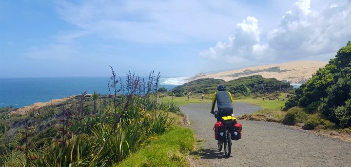
Our next objective on this coast is the Kauri forests, a couple of days away from Ahipara. On this coast, it seems that forests generally occupy a higher percentage of land than grasslands, unlike the East coast. The forests remain tropical and dense. The giant ferns still stand out as the most extraordinary species for us. We have learned that their real name is black tree fern. It turns out that it is one of the fern species most resistant to direct sunlight. Surely that's why it can reach heights of up to 20 meters, the tallest in this family of plants.
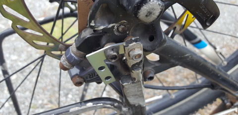 On this road Cèsar, in his usual distraction, catches a pothole with the rear wheel and Catacrak! The other part that held the rack to the bike frame breaks. Luckily we had already purchased spare parts at Russel's hardware store. However, those parts are for furniture and home repairs but that's what was available. The result is that his bike starts to look like a Picasso design. The right angle mending plate even looks aerodynamic.
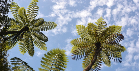
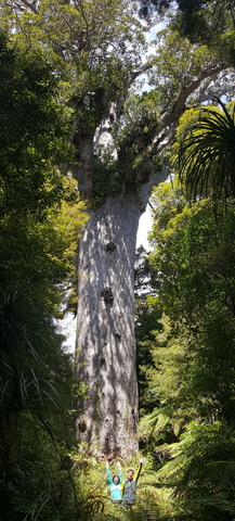
The next walk take us to see the thickest standing kauri: Te Matua Ngahere (girth=16.4 m). The hikes along the elevated wooden walkways are great. The variety and quantity of plant species exceeds any expectation. Any potential vegetation opening is occupied by a fern, moss, bush, tree or vine. Fallen trunks serve as a pot for new plants. The vitality of this forest is incredible.
The end of the route through the Waipoua forest is also special. The campsite manager is a bicycle enthusiast and rewards all cyclists who arrive here with a free beer.
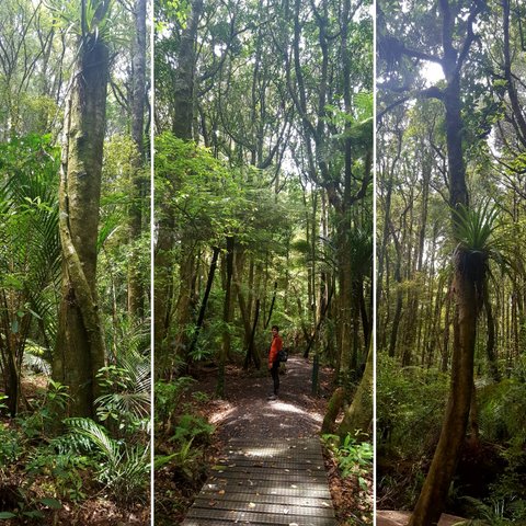
The next day we visit the Trounson forest. Unlike Waipoua, it’s a lot less dense and visibility trough the vegetation is much greater. From afar you can see the soft trunks of the kauris and the ecosystems they hold in their crowns. You can also follow the vines from trunk to trunk without losing them in the labyrinth of the vegetation. In all parks and official reserves there is a shoe cleaning station at the trailheads. First you scratch your boots against metal plates. Then you brush them. And finally you spray the soles with a fungicide. The objective is to avoid spreading the kauri dieback, a fungus that ends up killing these ancient and spectacular trees.
© 2018 Explore Pangea. All Rights Reserved. Website Terms of Use.
